
Andheri (East), BKC, Ghatkopar witness thunder, lightning and downpour
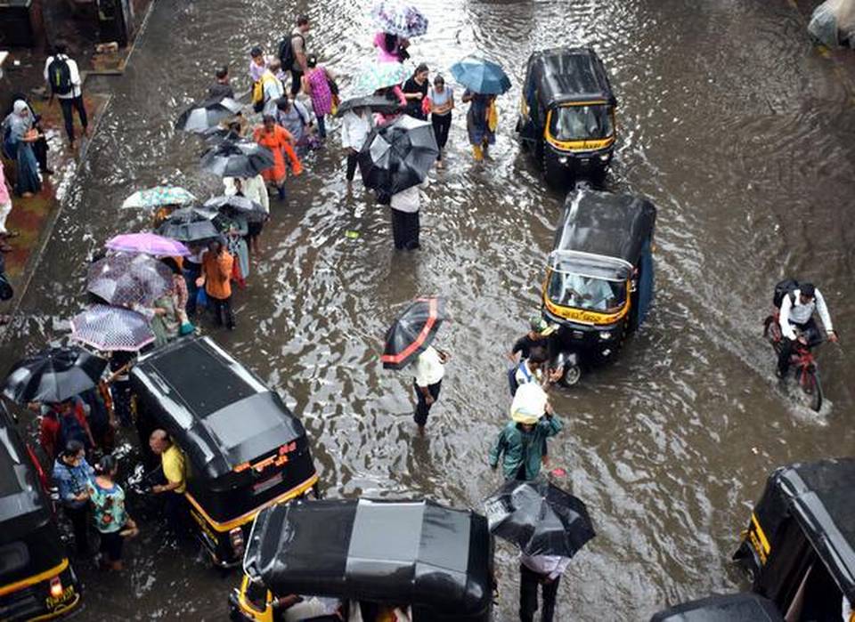
Moderate to heavy rains lashed Mumbai and nearby areas on Wednesday, with the Santacruz observatory recording 38.2 mm of rainfall in nine hours.
With heavy rain being forecast for Thursday, Education Minister Ashish Shelar announced on Twitter that schools and junior colleges in the city will remain closed as a precautionary measure.
Officials at the India Meteorological Department (IMD) said with the formation of favourable weather systems, rainfall over the Konkan and its adjoining areas was likely to increase in the next two to three days.
“The reason for this rainy episode will be the formation of a cyclonic circulation over Madhya Maharashtra by tomorrow. In fact, this system is expected to move towards the Konkan region. Moist winds from the Arabian Sea will aid in increasing the rainfall activity,” said Mahesh Palawat, chief meteorologist, Skymet. The private weather forecaster also warned of waterlogging in many parts of the city.
The IMD has already issued a red alert in isolated areas across Palghar, Thane and Raigad districts. Further, it projected that the city would witness a minimum temperature around 26 degrees Celsius and a maximum of 30 degrees Celsius in the next few days. According to the IMD, Mumbai, Pune, Raigad and Satara could receive rainfall greater than 204.4 mm on Wednesday along with thunderstorm activity, which would gradually decrease from September 21.
Mumbaikars took to social media to share details of the downpour accompanied by thunder and lightning around 2.30 p.m. in Andheri (East) that extended to Bandra Kurla Complex, Kurla and Ghatkopar.
K.S. Hosalikar, director general of meterology, IMD, tweeted, “Realised rainfall in last 24 hrs at 8 am in mumbai & around, indicate heavy falls in NM & Thane areas. Latest satellite image indicating active monsoon conditions over central India, Mah. Forecast is RF to continue over interiors and North Konkan next 24 hrs including Mumbai. (sic)”
Around 10 p.m. on Wednesday, IMD Mumbai officials issued a warning of thunderstorms accompanied with intense spells of rain in Thane, Raigad and Palghar during the next four hours. The forecast for Thursday on the IMD Mumbai website says, “Intermittent rain/showers likely in city and suburbs with possibility of extremely heavy falls at isolated places.”
This would be the third such extreme rainfall event this monsoon, after the deluge caused by heavy rains on July 1, when the city received the heaviest downpour of the season in just 24 hours — 375 mm recorded in the Santacruz meteorological station. This was followed by another around of heavy rain between September 4 and 6.